The latest Simrad App has been launched by the marine electronics leader celebrating its 75th anniversary this year.
The updated app includes a premium offering complete with new mapping features, advanced functionality and mirroring and control of Simrad multi-functional displays from your smartphone or tablet. It is available on both the Apple Store for iOS and Google Play for Android.
The app is free to download and offers a rich experience that includes free up-to-date nautical charts from C-MAP, personal waypoints, routes and tracks, latest marine weather, personalisation and much more.
The app also allows you to register your Simrad device(s) ensuring you have the latest software, manuals, information and product tips, as well as the ability to synchronise your waypoints and routes. The premium version has additional functionalities including stand-alone navigation.
“The new mirroring feature allows you to view and direct your Simrad electronics from anywhere on the boat right from the palm of your hand,” said James Methven, Global Head of Brand, Simrad Yachting.
“This easy integration with companion devices along with intuitive C-MAP charts and features make the Simrad app a no-brainer for any Simrad user to download and use.”
The premium version of the Simrad App offers Global charts and offline maps, High-Resolution Bathymetry Charts, Automatic Identification System (AIS), Simrad Community Traffic, 5-day weather overlay along route and 5-day weather overlay, GPS navigation data and line, track recording plus custom depth shading.
The full complement of weather data is provided in both versions including wind data, sea state, tides and currents, water temperature and much more. The Simrad App also features detailed fishing information for anglers and sport fishing enthusiasts.
“The simplified ‘freemium’ option provides a long list of technology and functionality right to your smartphone or tablet at no cost to enable your fishing, yachting and powerboating experience near shore or offshore,” added Methven.
“Plus, now we provide the option for an easy annual subscription upgrade to receive crucial premium features like offline charting and enhanced GPS data, custom depth shading and our new weather overlay for 5-days along your route.”
The C-MAP charts on the app are carefully designed to highlight what is most important at any given time during your boating experience, maintaining accuracy and a clean, uncluttered view.
Charts are powered by data from official hydrographic offices and continuously updated and augmented from thousands of data sources to enrich data near shore or offshore to provide clarity for your routing, whether that’s a short trip across the bay or longer voyage on the open water.
| FREE FOR ALL USERS | PREMIUM FEATURES |
|---|---|
| View the latest nautical charts | GPS Position & Full Navigation |
| Manual and Autorouting | Offline Maps (Global) |
| Manage your Waypoints, Routes & Tracks | 5-Day Weather Along the Route |
| GPX Import & Export | 5-Day Weather Overlay |
| Thousands of Points of Interest | High-Resolution Bathymetry |
| Marine Weather Forecast | Custom Depth Shading |
| Weather Overlay (24 hours) | AIS |
| Weather Along the Route (24 hours) | Traffic: View other App users around |
| Chart Personalisation | Shaded Relief |
| Measure Distance Tool | |
| Waypoints & routes synchronisation with Simrad compatible devices | |
| Device Support: Registration, Guides and Software Updates |
For more information on Simrad and its celebration of 75 years of innovation this year or to download the app, go to: www.simrad-yachting.com
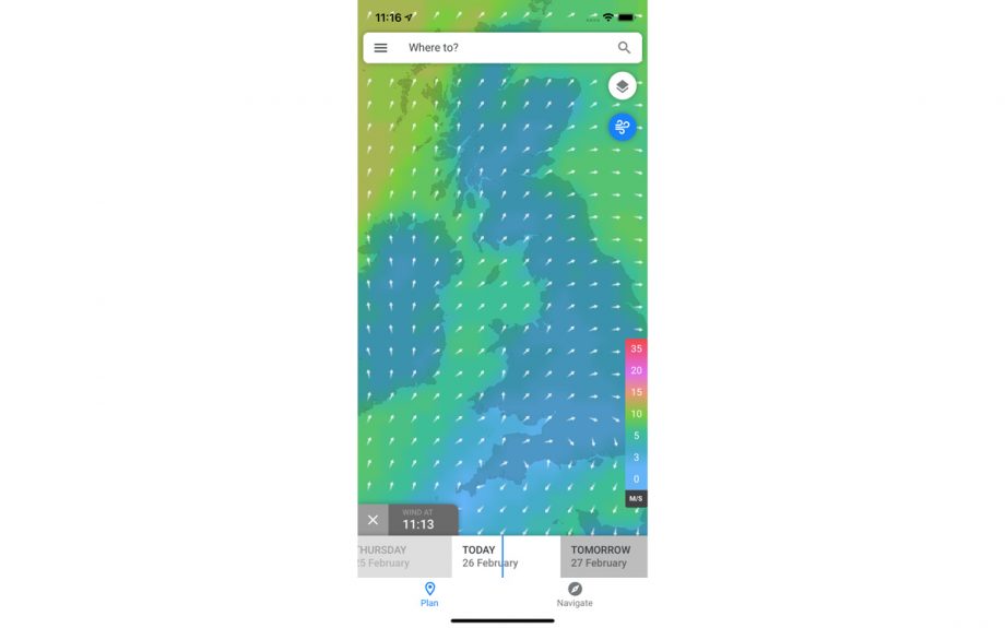
Wind overlay

Weather along route

High resolution bathymetry

Custom depth shading