The island unveils some hidden pleasures plus some unforeseen dangers
Position: Cumberland Bay, Robinson Crusoe Island Juan de Fernandez Islands, Chile (339nm offshore)
Scott (YT) and Mary Flanders (MS) left Gibraltar on 16 September 2006, and we’ll be following their journey every step of the way, thanks to this unique online “blog”. For a complete list of all the couple’s blog entries click here
The island unveils some hidden pleasures plus some unforeseen dangers
Thursday 10 April
Well, mis amigos, another big hike to the east end of the island with theOn Veracrew. It was another Olympic event to the top where the radio antennas are located. Much of the trail is quite crumbly with dried clay that is unstable and gives way. Alfredo, our Italian friend, spun out a couple of times on the way up. We heard a story about a local who was walking with his kids a few years ago when he decided to take a short cut. Unfortunately he slipped then and slid down to the rocks below. Very sad. It was windy and cool as the top but the view was priceless. We would love to explore the entire island but we simply don’t have time (winter is on its way). On the way down we stopped to pick some ‘two bite’ berries. Alfredo told us that you should soak the berries in rum and then put them in the sun. You are then supposed to eat the berries with a spoon and spit out the chaff. We’re going to have to give that a try.
At the bottom of the trail is the Cumberland Restaurante, where Frank had gone ahead for his afternoon beer. By the time we caught up with Frank he had cornered the outside table and was in deep conversation with a young two-year-old. Frank was completely charmed by her big brown eyes and pretty smile. Soon a local lady walked by and the little sweetie ran out and started talking to her, turning on the charm. The lady reached in her purse and gave her a candy bar. They’re all alike women, no matter what the age.
While we were away the wind had swung and forcedEgretto sail east towards the rocks, close to a mooring that had been left vacant by the Finnish/German boat. Luckily the American single-hander was concerned so he dinked over and used his line to secureEgretto the mooring as well. Another case of how we all look out for each other.
Friday 11 April
All three sailboats left today about two hours apart. They all left for Easter Island riding the SE’ly. We still have some exploring to do before we leave as well, also for Easter. These three boats are very experienced (two have circumnavigated). None of the boats have refrigeration or radar and only one can receive weather via the SSB. One has a broken laptop but uses a handheld GPS and charts. This is not the way we prefer to travel and probably not theirs. However, they are ‘out here’ seeing the same sights asEgretrather than at home working.
Today there was a large swell/surge in the bay and we attempted to land for a hike ashore but it was too much. We retreated back toEgretand spent the day reading.
Saturday 12 April
With a new landing strategy we leftEgretmid-morning for a hike around the west end of the island. To do this we landed on the dock ladder and used a very long line to move the dink into position and tied it off with two lines.
We came to the end of the trail and walked past the cliffs where there is WWI British shell damage from where three British warships engaged the German battleship Dresden. In a nutshell, the Dresden was sent to the South Pacific to harass shipping but in the end ran out of coal. The Dresden took refuge in Cumberland Bay (Egret’sanchorage) and sent emergency messages for a ship to deliver more coal. The Brits intercepted the messages and sent a three-boat fleet to deal with the battleship. After a short battle the German captain chose to save his crew and desert the battleship. There is a little museum which has pictures taken in sequence of the ship sinking. Today it is a popular dive site for the few tourists that arrive to this small island.
At the end of the trail we turned left and started climbing. The ground consisted of dry, crumbly clay but we kept climbing higher hoping to get to the trees, some ground cover and stability. To make a long story short it was probably the most dangerous thing we have ever done…ever. We became separated after I tried to climb higher to find a route out, while Mary and Frank reversed their route. Much later we arrived at the bottom, in two different places at the same time. All I could think about was Mary and although she was calling to see how I was doing I couldn’t hear her. Later at a restaurant the owner said 21 years ago he did the same thing as a boy. He said occasionally a horse or mule will slip and fall and kill themselves.
Sunday 13 April am
It is 35 knots in the bay but the waves are still quite small. We have the paravane arms deployed with flopper stoppers so there is no problem. As we said before, the weather is changing. The normal high between here and Easter is becoming unstable. As soon as we get OMNI Bob’s blessing we’ll head WNW.
Sunday 13 April pm
We are now boat bound in the high winds. The surge would be too great to land and I don’t want to leave the boat without an anchor watch.
OMNI Bob’s forecast is below. I won’t preach again on the safety of professional long range forecasting but you can see why in the report below. We could ride the SE’lys to the NW then turn more west but we would run into large head seas, something we don’t want for two reasons. Firstly it would kill the fuel mileage and secondly we need four full days before we can empty the 150gal forward fuel bladder in order to lower the majority of high weight and this needs to be done in relatively calm seas. OMNI Bob has picked up the long-term weather shift, describing the reasons, while our grib weather only reaches three days.
OMNI Bon
“We suggest waiting for a better weather pattern. If you need to depart we would suggest a NNW heading forward 28S-27S for at least the first 3-5 days, then adjusting to a more WNW-W heading as conditions improve. Along this route expect:
Monday 14-Tuesday 15:S-SE 17-25kt, gusty 30kts at times. Waves 2m-2.5m, swells SW-S 2-3m. Winds easing S-SE 15-20kts to 12-18kts through Tuesday evening/night. Waves subside 1.5-2.m through Tuesday afternoon, then 1-1.5m through Tuesday night.
Wednesday 16:SSE-SE 12-16kts, waves 1-1.5m. Swells SSW to SSE 1.5-2.5m, possibly mixing NW-WNW 1.2-m during Wednesday pm.
Thursday 17:S-SE to Var 07-14kts. Waves 1.m. Swells confused to WNW-WSW 1.5-2.5m.
Friday 18:Var to N-NW 12-18kts, Waves 1-1.5m. WNW to WSW 2-3m, up to 3.5m would be possible by the pm/hrs”.
We’ll take Bob’s advice and wait for the weather to improve. Hopefully today we can make it ashore but things need to lay down a bit first. So there you have it, a few more days in the life.
First picture: Alfredo and Mary with a carving from a local artist.
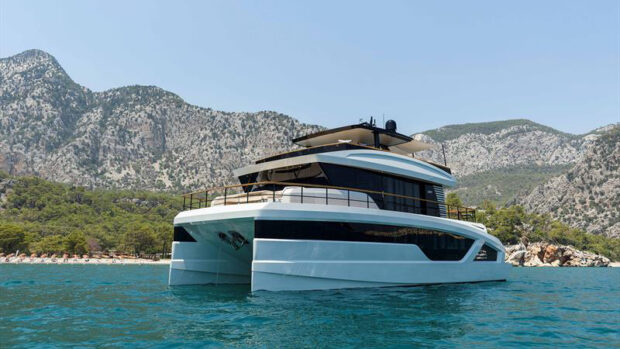
Second picture: Cumberland Bay (picture taken from the east), Village of Juan Batista (The WWI German battleship Dresden was scuttled in the west side of the bay).