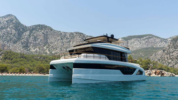
Motor Boat & Yachting's resident expert, Jon Mendez explains the first steps to creating a passage plan for crossing the English Channel
Last month I explained why it’s important to make a proper passage plan for every boat trip, however small, and how to do that by using the recommended APEM mnemonic (Appraise, Plan, Execute and Monitor). To illustrate the Appraise part of it, we looked at how you might go about preparing for a cross-Channel passage from Poole to Honfleur. This month we’ll be looking at the Plan stage of this trip; specifically choosing waypoints and working out tides and timings.
Most people only use waypoints when a change of heading is required, but they can also be used as reminders to do something. In our route from Poole to Honfleur, for instance, I might add a waypoint as we leave UK waters on the edge of the 12-mile limit; then another to let me know we’re approaching a traffic separation zone (we don’t actually cross the formal TSS on this route but we’ll still need to check for traffic); then another on our arrival into French waters to remind me to put up our courtesy flag; and finally a radio check-in point for the port of entry with the right VHF channel number and so on.
The next stage is to decide on your passage date and time. This may be determined by tidal constraints. Most of the ports along the Normandy coast have tidal restrictions on entry. The only exception is Cherbourg, much further west.
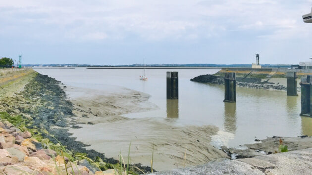
Technically, Honfleur has a 24-hour lock but at low tide the approach channel is so shallow and silted at the edges that you need to hold a very central line for entry. To be safe, I’d aim for an arrival window on a rising tide, with at least half the tide already in.
Article continues below…

How to carry out pre-season motor yacht checks

How to plan a safe passage at sea: An expert guide
The tidal port for Honfleur is Le Havre, which, according to the almanac, is about an hour earlier than Dover. Honfleur itself is about an hour earlier again. So High Water Honfleur is roughly two hours earlier than Dover in the UK. Based on that, a Dover high tide in the early evening, say 1900, would give a Honfleur High Water of 5pm so our planned mid-tide arrival would mean reaching Honfleur from1400 onwards.
Based on the seven-hour passage time we calculated during the Appraise stage, that would require leaving Poole at 0700. There is a slight catch, though, as France is one hour ahead of UK time so with a 0700 departure our actual arrival time will be 1500 local time. I’m happy with that as it’s still two hours before HW.
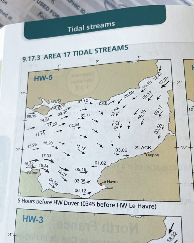
Lastly, we need to factor in the conditions as seven hours at sea is a long time in a small boat, which could easily be aggravated by any wind against tide. A check of the tidal almanac shows that on leaving Poole, the tide would initially be flowing west, Slack Water would be roughly five hours into the journey and then the tide would turn and flow east.
This means at least part of the passage is likely to be wind against tide so I’d aim to make the passage when the forecast is for less than a Force 4.
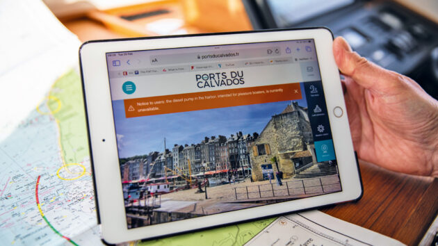
Research – The first step is to check for any tidal limitations at the port of entry. The port’s own website should tell you this along with a mine of other useful information. Often this includes a live webcam showing the current conditions.
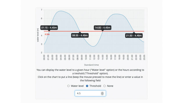
Timing – Honfleur’s website even has the facility to place your own minimum depth line through the lock’s tidal curve, showing what your earliest and latest arrival and departure times should be.
Conditions – Honfleur’s webcam shows live images of the entrance, which is a great way to familiarise yourself with how it looks at both low and high water and in different wind states.
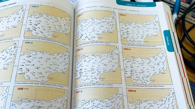
Tides – I find a printed tidal atlas is quicker and easier to use than the plotter as you can see all the hours at once. We are aiming to leave at HW+1 Dover so we have a West-going tide for the next five hours.
Arrival – It’s also worth checking the tidal flow at your destination. At the time of our planned arrival at the entrance to the Seine, where Le Havre is situated, the tide will be with us and will help carry us towards the harbour.
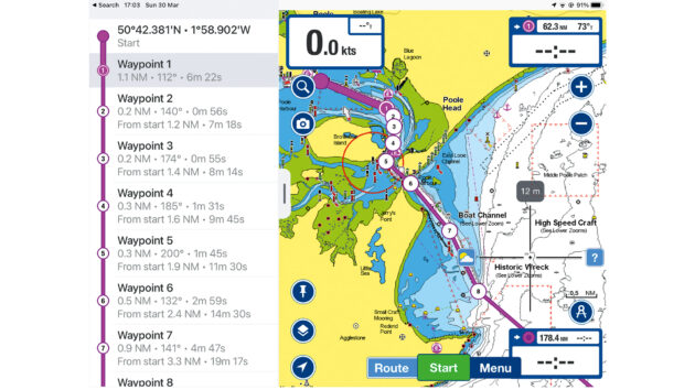
Waypoints – I find the simplest way of recording a route plan is by using a screenshot. This one is from an iPad but I can save it to multiple devices and share it with the crew to build in a degree of redundancy.
 If you enjoyed this….
 If you enjoyed this….
Motor Boat & Yachting is the world’s leading magazine for Motoryacht enthusiasts. Every month we have inspirational adventures and practical features to help you realise your sailing dreams, as well as tests and news of all the latest motorboats.
Plus you’ll get our quarterly Custom Yachting supplement where we share the last on offer in the superyacht world and at the luxury end of the market.
Build your knowledge with a subscription delivered to your door. See our latest offers and save at least 30% off the cover price.
Note: We may earn a commission when you buy through links on our site, at no extra cost to you. This doesn’t affect our editorial independence.